
Island of Minorca


Section: Cartas naúticas
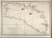
Title: Island of Minorca [Material cartográfico] / Surveyed by Brigadier Don Vicent Tofiño
Área de datos: [ca. 1:117.370]. 6 Maritime Miles [7,1 cm]
Publication: London : Published by W. Faden, Geographer to His Majesty, and to His Royal Highness the Prince Regent, 1812
Physical description: 1 mapa ; 27 x 35 cm
Género / forma: Cartas náuticas
Hierarchical place name: España - Baleares Menorca
Otros autores: Faden, William, 1750-1836
Dougall, John, 1760-1822, trad.
Títulos secundarios: Menorca (isla). Carta naútica (1812)
Type of publication:
 Maps
Maps
Derechos:
Naval Museum
Signature: MN_A_10022_27