
Colton's Germany n. 1 : the eastern provinces of Prussia...


Section: Maps
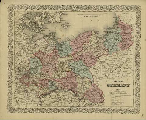
Title: Colton's Germany n. 1 : the eastern provinces of Prussia and Saxony
Author: Colton, George Woolworth, 1827-1901
Área de datos: Escala [ca. 1:3.003.000], 60 miles [= 3'7 cm] (E 10º--E 23º /N 56º--N 50º)
Publication: New York : published by G.W. and C.B. Colton & Co., [1872]
Physical description: 1 mapa : col. ; 36 x 44 cm
Notes: Indica meridianos de origen: Washington y Greenwich ; Márgenes graduados.
Indica divisiones administrativas marcadas por colores.
Incluye clave de signos indicando red de carreteras, ferrocarriles, canales y ciudades.
Inserta nota: "Entered according to Act of Congress in the year 1855 by J.H. Colton & Co. in the Clerk's office of the district court for the southern district of New York".
Registros relacionados: En: Colton's General Atlas : containing one hundred and eighty steel plate maps and plans, on one hundred and nineteen imperial folio sheets. - New York : published by G.W. and C.B. Colton & Co. n 172 William St., [1872]. - Nº 107
Materia / lugar / evento: Mapas políticos
Alemania
Prusia - S. XIX - Mapas
Sajonia - S. XIX - Mapas
Polonia - Mapas
Alemania - Mapas
Otros autores: G.W. & C.B. Colton & Co.
Títulos secundarios: EUROPA. N. Mapas políticos. 1:3003000 (1872)
UDC: 912:32]:[625.1+625.7](438-2/-5+430.2-2/-5)'1872'
438-2/-5
(430.2-2/-5)
Type of publication:
 Maps
Maps
Derechos: