
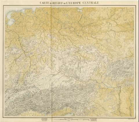
Carte du relief de l'Europe centrale


Section: Maps
Title: Carte du relief de l'Europe centrale
Author: Dubail, E., fl. 1880
Área de datos: Escala [1:1.500.000]
Publication: [París] : Librairie, J. Dumaine, Editeur, [1880]
Physical description: 1 mapa : col. ; 66 x 78 cm, en h. de 73 x 82 cm, pleg. en 43 x 31 cm
Notes: Indica relieve: curvas de nivel.
Incluye: nota explicativa del contenido del mapa
Registros relacionados: En: Atlas de l'Europe militaire. - Paris : Libraire Militaire de J. Dunnaine Libraire - Editeur, 30 Rue et Passage Dauphine, 30, 1880
Materia / lugar / evento: Orografía
Mapas militares
Europa central - Mapas
Hierarchical place name: Europa central
Títulos secundarios: Europa. Central. 1:1500000
UDC: 912:911.2]:[551.43:355.47](4-191.2)'1880'
4-191.2
Type of publication:
 Maps
Maps
Derechos: