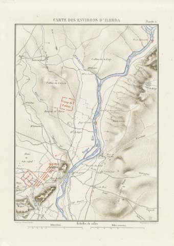
Plan de Lérida


-
Sail: Planos
Izenburua: Plan de Lérida
Datu-area: Escala 1:10000
Argitalpena: [París : Impimerie Nationale, 1887]
Deskribapen fisikoa: 1 plano : col. ; 16x12 cm, en h. de 52x35 cm, pleg. en 26x35 cm
Oharrak: Escala gráfica además en 'métres'
Relieve : curvas de nivel, puntos acotados, sombreado
Orientado con flecha
Figura superpuesta el plano de la ciudad del siglo XIXErregistro erlazionatuak: En: [Histoire de Jules César] [atlas]. - [Paris : Henri Plon, Editeur, rue Garanciére 8, 10, 188-]. - Planche 6
Materia / lugar / evento: Guerras
Mapas militares
Imperio romano
Lérida Tokiaren izen hierarkikoa: España - Cataluña - Lérida - Lérida
Bigarren mailako izenburuak: Lleida. Planos de población. 1887. 1:10000 (53-44 a.d.C)
CDU: 912:[355.52:355.43:355.4:625.7](467.12 Lérida)'-0053/-0044'
37
(467.12 Lérida)
912:314(467.12 Lérida):(084.3)Argitalpen mota:
 Mapak
Mapak
Derechos:
Madrileko Artxibategi Militar Nagusiko KartotekaBilduma: SH — Signatura: AT-38/5 inserta 1