
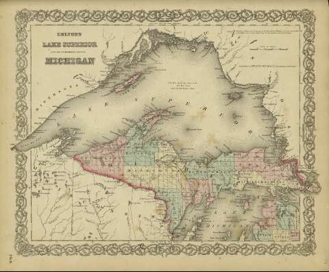
Colton's Lake Superior and the northern part of Michigan


Sail: Mapak
Izenburua: Colton's Lake Superior and the northern part of Michigan / [drawn by George Woolworth Colton]
Autorea: Colton, George Woolworth, 1827-1901
Datu-area: Escala [ca. 1:1.889.643], 50 miles [= 4'9 cm] (O 92º--O 84º /N 49º--N 45º)
Argitalpena: New York : published by G.W. and C.B. Colton & Co., n 172 William St., [1872]
Deskribapen fisikoa: 1 mapa : col. ; 36 x 44 cm
Oharrak: Indica meridianos de origen: Washington y Greenwich ; Márgenes graduados.
Indica divisiones administrativas marcadas por colores.
Inserta nota: "Entered according to Act of Congress in the year 1855 by J.H. Colton & Co. in the Clerk's office of the district court for the southern district of New York".
Erregistro erlazionatuak: En: Colton's General Atlas : containing one hundred and eighty steel plate maps and plans, on one hundred and nineteen imperial folio sheets. - New York : published by G.W. and C.B. Colton & Co. n 172 William St., [1872]. - Nº 64
Materia / lugar / evento: Divisiones administrativas - Mapas
Superior (Lago) - Mapas
Michigan (Estado) - Mapas
Tokiaren izen hierarkikoa: Estados Unidos Lago Superior
Estados Unidos - Michigan
Bigarren mailako izenburuak: MICHIGAN (Estados Unidos) (Estado). 1:1889643
CDU: 912:911.2]:[556.55+625.1](774-2/-5)
774-2/-5
Argitalpen mota:
 Mapak
Mapak
Derechos: