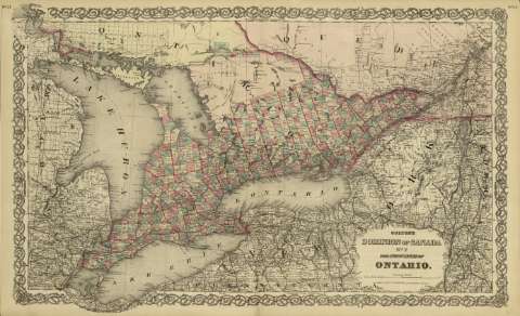
Colton's Dominion of Canada n. 2 : the province of Ontario


-
Sección: Mapas
Título: Colton's Dominion of Canada n. 2 : the province of Ontario / [drawn by George Woolworth Colton]
Área de datos: Escala [ca. 1:1.797.913], 100 miles [= 10'3 cm] (O 84º40'--O 73º00' /N 46º50'--N 42º00')
Publicación: New York : published by G.W. and C.B. Colton & Co., [1872]
Descripción física: 1 mapa : col. ; 44 x 70 cm, pleg. en 44 x 36 cm
Notas: Indica meridianos de origen: Washington y Greenwich ; Márgenes graduados.
Indica divisiones administrativas marcadas por colores.Registros relacionados: En: Colton's General Atlas : containing one hundred and eighty steel plate maps and plans, on one hundred and nineteen imperial folio sheets. - New York : published by G.W. and C.B. Colton & Co. n 172 William St., [1872]. - Nº 21 - 22
Materia / lugar / evento: Mapas políticos
Divisiones administrativas - Mapas
Canadá - Mapas
Ontario - Mapas Nombre jerárquico lugar: Canadá - Ontario
Otros autores: G.W. & C.B. Colton & Co.
Títulos secundarios: ONTARIO (Canada) (Provincia). 1:1797913
CDU: 912:32(71 Ontario)'1872'
71 OntarioTipo de publicación:
 Mapas
Mapas
Derechos:
Cartoteca del Archivo General Militar de MadridColección: SH — Signatura: AT-24/12