
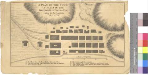
A Plan of the Town of Payta in tne Kingdom of Santa-Fee :...


Section: Planos
Title: A Plan of the Town of Payta in tne Kingdom of Santa-Fee [Material cartográfico] : Lying in the Latitude of 5 d. 12m, S°
Área de datos: Escala [ca. 1:1351]
Publication: [S.l. : s.n., 1701?]
Physical description: 1 mapa ; 22 x 38 cm
Notes: Escala gráfica de cuarenta poles ingleses [= 14,9 cm]
Relieve representado por normales
Relación de los principales edificios de la ciudad
Copia digital. Madrid : Ministerio de Cultura. Dirección General del Libro, Archivos y Bibliotecas, 2010
Materia / lugar / evento: Piura - S. XVIII - Mapas
Género / forma: Planos de población
Hierarchical place name: Perú - Piura
Títulos secundarios: PAITA (Perú). Planos de población. 1:1351 (1701?)
UDC: 852.3 Paita
Type of publication:
 Maps
Maps
Derechos: