
Colton's Dakota and Wyoming


Section: Maps
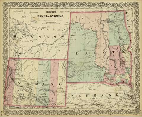
Title: Colton's Dakota and Wyoming / [drawn by George Woolworth Colton]
Author: Colton, George Woolworth, 1827-1901
Área de datos: Escala [ca. 1:3.094.904], 100 statue miles [= 5.2 cm]
Publication: New York : published by G.W. and C.B. Colton & Co., [1872]
Physical description: 1 mapa ; 44 x 36 cm
Notes: Indica meridianos de origen: Washington y Greenwich ; Márgenes graduados.
Indica divisiones administrativas marcadas por colores.
Inserta nota: "Boundary Line between the United States and British Territory according the Treaty of 1846".
Registros relacionados: En: Colton's General Atlas : containing one hundred and eighty steel plate maps and plans, on one hundred and nineteen imperial folio sheets. - New York : published by G.W. and C.B. Colton & Co. n 172 William St., [1872]. - Nº 77
Materia / lugar / evento: Mapas políticos
Divisiones administrativas - Mapas
Dakota del Norte (Estados Unidos) - Mapas
Dakota del Sur (Estados Unidos) - Mapas
Wyoming (Estados Unidos) - Mapas
Hierarchical place name: Estados Unidos - Dakota del Norte
Estado Unidos - Dakota del Sur
Estados Unidos - Wyoming
Otros autores: G.W. & C.B. Colton & Co.
Títulos secundarios: ESTADOS UNIDOS. Central. Divisiones administrativas (1872)
UDC: 912:911.2
(783)
(784)
(787)
Type of publication:
 Maps
Maps
Derechos: