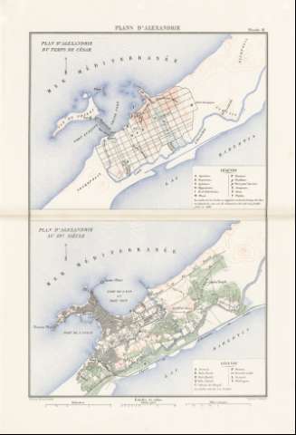
Plan d'Alexandrie au 19e. siécle


-
Section: Planos
Title: Plan d'Alexandrie au 19e. siécle
Author: Schieble, Erhard
Área de datos: 1:40000
Publication: [París] : Imprimerie Nationale, [1887]
Physical description: 1 mapa : col. ; 21 x 28 cm en h. de 52 x 35 cm, pleg. en 26 x 35 cm
Notes: Escala gráfica además en "kilométres" y "Milles romains"
Relieve representado por curvas de nivel
Figura leyenda alfabética de los lugares importantes del mapaRegistros relacionados: En: Histoire de Jules César : Guerre Civile : Planches : [atlas]. - París : Imprimerie Nationale, 1887. - Pl. 19
Hierarchical place name: Egipto - Alejandría
Títulos secundarios: ALEJANDRIA (Egipto). 1:40000
UDC: 912:314(620 Alejandría)(084.3)
912:627.22]:[725.344:626.7:625.1:623.2] (620 Alejandría)'1800'
620 AlejandríaType of publication:
 Maps
Maps
Derechos:
Map Library of the General Military Archive of MadridColección: SH — Signature: AT-38/19 inserta 1