
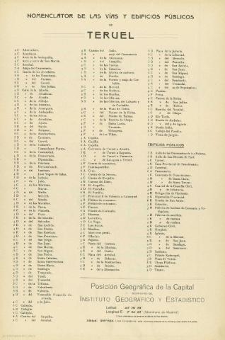
Plano de Teruel


Section: Planos
Title: Plano de Teruel
Área de datos: Escala 1:4.000
Publication: Barcelona : Alberto Martín, [entre 1900 y 1920]
Physical description: 1 plano : col. ; 36 x 52 cm, pleg. en 26 x 39 cm
Notes: Incluye índice de vías y edificios públicos.
Indica relieve representado por curvas de nivel.
Registros relacionados: En: España Regional. - Barcelona : Alberto Martin, [entre 1900 y 1920]
Materia / lugar / evento: Planos de población
Teruel - Planos
Hierarchical place name: España - Aragón - Teruel - Teruel
Títulos secundarios: Teruel. Planos de población. 1900-1920. 1:4000
UDC: 912:314(465.23 Teruel)'1900/1920'(084.3)
465.23 Teruel
Type of publication:
 Maps
Maps
Derechos:
Map Library of the General Military Archive of Madrid
Colección: SH — Signature: AT-16B/9