
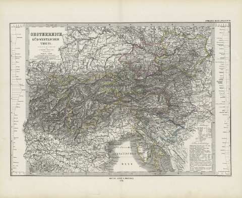
Oesterreich, süd westlicher theil : [generalkarte]


Section: Maps
Title: Oesterreich, süd westlicher theil : [generalkarte] / entworfen bearbertet von Herman Berghaus ; gestochen v.W. Alt, berge V.C. Jungmann
Área de datos: Escala 1:1850000
Publication: Gotha [Alemania, R.D.] : Justus Perthes, 1879
Physical description: 1 mapa : col. ; 29x41 cm, en h. de 39x48 cm, pleg. en 39x24 cm
Notes: Coordenadas : E26 10'-E34 30'/N49 05'-N44 25'. Meridiano de Ferro. Constan ademas coordenadas según el meridiano de París
Relieve : sombreado
Leyenda de signos utilizados
Inserta : 2 mapas de altitudes
Registros relacionados: En: Hand atlas : über alle Theile der Erde und über das Weltgebäude. - Gotha [Alemania R.D.] : Justus Perthes, [1879]. - N 28
Materia / lugar / evento: Mapas generales
Yugoslavia
Austria
Otros autores: Berghaus, Herman, 1828-1890
Stieler, Adolf, 1775-1836
Alt, W.
Jungmann, C.
Perthes, Justus, 1749-1816
Títulos secundarios: Europa. Central. 1:1850000
UDC: 912:341.222(436-2/5+437.1)'1879'
436
437.1
Type of publication:
 Maps
Maps
Derechos: