
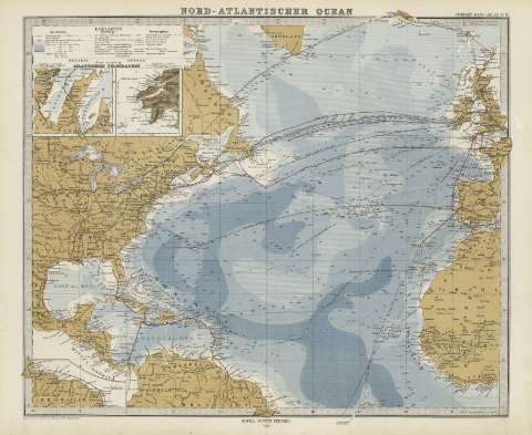
Nord-Atlantischer Ocean


Section: Maps
Title: Nord-Atlantischer Ocean / entw. G. gez. v. Hermn Berghaus
Author: Berghaus, Herman, 1828-1890
Edición: [Ed.] 1867, nachtr 1878
Área de datos: [Ca. 1:5444444], 10 [= 4,9 cm] (O 50 -E 0 /N 63 -N 0)
Publication: Gotha [Alemania] : Justus Perthes, 1879
Physical description: 1 mapa : col. ; 35 x 41 cm en h. de 39 x 48 cm, pleg. en 39 x 24 cm
Notes: Constan ademas coordenadas según el meridiano de París y de Hierro
Leyenda de signos utilizados
Inserta: Atlantischeen Telegraphen
Registros relacionados: En: Hand atlas : über alle Theile der Erde und über das Weltgebäude. - Gotha [Alemania R.D.] : Justus Perthes, [1879]. - N. 12
Materia / lugar / evento: Telegrafía
Cables submarinos
Batimetría
Atlántico septentrional
Hierarchical place name: Atlático Norte
Títulos secundarios: ATLANTICO (Océano). N. 1:5444444
UDC: 912:911.2]:[654.1:621.315.2:551.46](261.1)'1867'
261.1
Type of publication:
 Maps
Maps
Derechos: