
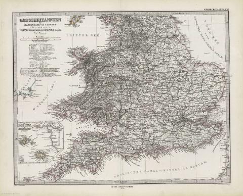
Grossbritannien im maassstabe von 1:1500000


Section: Maps
Title: Grossbritannien im maassstabe von 1:1500000 / Von A. Petermann ; bearb v. Ernst Debes ; Gest. v. Poppey u. Jungmann
Área de datos: Escala 1:1500000 (O 7º00'-E 2º30'/N 6º55'-N 5º00')
Publication: Gotha [Alemania] : Justus Perthes, 1879
Physical description: 1 mapa en 2 h. : col. ; h. de 39 x 48 cm, pleg. en 39 x 24 cm
Notes: Coordenadas referidas a los meridianos de París y Hierrro
Relieve representado por normales
Leyenda de signos utilizados
Mapa fraccionado
Inserta: "Die Canal-Inseln (Channel-Island)". Escala 1:1000000 ; "Edinburgh und Umgebung". Escala 1:150000
Contenido incompleto: Contiene: Sudliches blatt : England (chne die nordl.-Grafschaften) V. Wales ; Nordliches blatt : Schottland u. der Nordlichste theil England's
Registros relacionados: En: Hand atlas : über alle Theile der Erde und über das Weltgebäude. - Gotha [Alemania R.D.] : Justus Perthes, [1879]
Materia / lugar / evento: Mapas generales
Edimburgo
Reino Unido
Hierarchical place name: Gran Bretaña
Otros autores: Petermann, Augustus Herman, 1822-1898
Debes, Ernst, 1840-1923
Poppey
Jungmann, C.
Títulos secundarios: REINO UNIDO. 1:1500000
UDC: 912:341.222(410-2/-5)'1879'
410
912:314(410 Edimburgo)(084.3)'1879'
Type of publication:
 Maps
Maps
Derechos: