
Colton's Georgia


Section: Maps
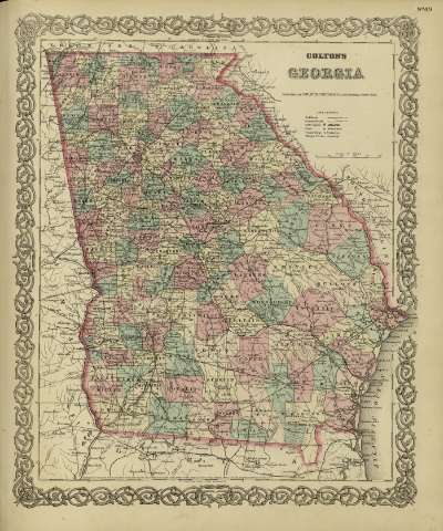
Title: Colton's Georgia / [drawn by George Woolworth Colton]
Author: Colton, George Woolworth, 1827-1901
Área de datos: Escala [ca. 1:1.815.539], 50 miles [= 5'1 cm] (O 85º45'--O 81º00' /N 35º10'--N 30º05')
Publication: New York : published by G.W. and C.B. Colton & Co., [1872]
Physical description: 1 mapa : col. ; 44 x 36 cm
Notes: Indica meridianos de origen: Washington y Greenwich ; Márgenes graduados.
Indica divisiones administrativas marcadas por colores.
Incluye clave de signos indicando red de carreteras, ferrocarriles, canales y ciudades.
Inserta nota: "Entered according to Act of Congress in the year 1855 by J.H. Colton & Co. in the Clerk's office of the district court for the southern district of New York".
Registros relacionados: En: Colton's General Atlas : containing one hundred and eighty steel plate maps and plans, on one hundred and nineteen imperial folio sheets. - New York : published by G.W. and C.B. Colton & Co. n 172 William St., [1872]. - Nº 49
Materia / lugar / evento: Mapas políticos
Divisiones administrativas - Mapas
Georgia (Estados Unidos, Estado) - Mapas
Hierarchical place name: Estados Unidos - Georgia
Otros autores: G.W. & C.B. Colton & Co.
Títulos secundarios: GEORGIA (Estados Unidos). 1:1815539
UDC: 912:911.2]:[625.1+625.7](758-21-5)'1872'
758
Type of publication:
 Maps
Maps
Derechos: