
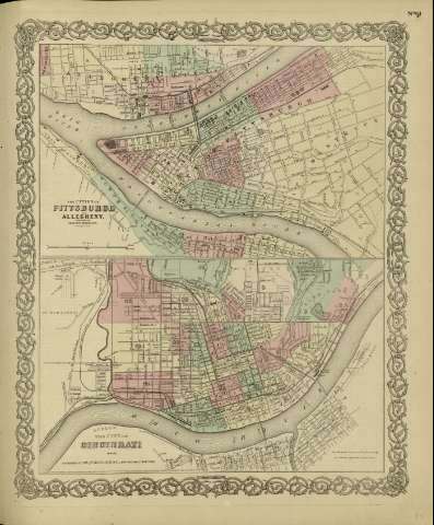
The city of Cincinnati, Ohio


Section: Maps
Title: The city of Cincinnati, Ohio / [drawn by George Woolworth Colton]
Author: Colton, George Woolworth, 1827-1901
Área de datos: Escala [ca. 1:28.490], 1 mile [= 6'5 cm]
Publication: New York : published by G.W. and C.B. Colton & Co., [1872]
Physical description: 1 mapa : col. ; 18 x 44 cm, en h. de 44 x 36 cm
Notes: Indica divisiones administrativas marcadas por colores.
Con: The cities of Pittsburch and Allegheny.
Inserta nota: "Entered according to Act of Congress in the year 1855 by J.H. Colton & Co. in the Clerk's office of the district court for the southern district of New York".
Registros relacionados: En: Colton's General Atlas : containing one hundred and eighty steel plate maps and plans, on one hundred and nineteen imperial folio sheets. - New York : published by G.W. and C.B. Colton & Co. n 172 William St., [1872]. - Nº 61
Materia / lugar / evento: Planos de población
Cincinnati (Ohio, Estados Unidos) - Planos
Hierarchical place name: Estados Unidos - Cincinnati
Otros autores: G.W. & C.B. Colton & Co.
Títulos secundarios: CINCINNATI (Estados Unidos) (Ohio). 1:28490
UDC: 912:[711.4+625.712+625.1+556.53](771 Cincinati)'1872'
771 Cincinati)
912:314(771 Cincinnati)(084.3)
Type of publication:
 Maps
Maps
Derechos: