
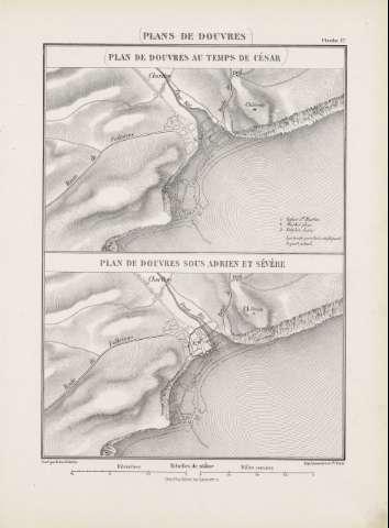
Plan de Douvres sous Adrien et Sévère


Section: Planos
Title: Plan de Douvres sous Adrien et Sévère / gravé par Erhard Schièble
Author: Schieble, Erhard
Área de datos: Escala 1:20000
Publication: [París] : Henri Plon Éditeur, rue Garanciére 10, [188-]
Physical description: 1 mapa ; 14 x 20 cm en h. 37 x 27 cm
Notes: Escala gráfica además en 'Kilometres' y 'Milles romains'
Relieve representado por normales
Indica las carreteras de algunas ciudades
Señala algunos puertos
Registros relacionados: En: Histoire de Jules César : Guerre Civile : Planches : [atlas]. - París : Imprimerie Nationale, 1887. - Planche 17
Materia / lugar / evento: Imperio romano
Guerras
Dover (Reino Unido)
Hierarchical place name: Gran Bretaña - Dover
Títulos secundarios: Dover. Mapas militares. 1887. 1:20000 (I siglo a. C)
UDC: 912:355.4](410-12)'117/201'
37
410-12
Type of publication:
 Maps
Maps
Derechos: