
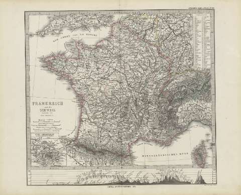
Frankreich und die Schweiz : [generalkarte]


Section: Maps
Title: Frankreich und die Schweiz : [generalkarte] / bearbeitet von Hrm. Berghaus ; Gest V.W. Alt, terrain V.W. Weiler
Author: Berghaus, Herman, 1828-1890
Área de datos: Escala 1:3700000
Publication: Gotha [Alemania, R.D.] : Justus Perthes, 1879
Physical description: 1 mapa : col. ; 34x36 cm, en h. de 39x48 cm, pleg. en 39x24 cm
Notes: Coordenadas : E12 30'-E27 30'/N51 30'-N41 40'. Meridiano de Ferro.
Relieve : sombreado
Leyenda de signos utilizados
Inserta : Seine - Departement - - mapa de altitudes
Registros relacionados: En: Hand atlas : über alle Theile der Erde und über das Weltgebäude. - Gotha [Alemania R.D.] : Justus Perthes, [1879]. - N 33
Otros autores: Alt, W.
Weiler, W.
Títulos secundarios: Europa. Central. 1:3700000
UDC: 912:341.222(44-2/5+494-2/5)'1879'
44
494
Type of publication:
 Maps
Maps
Derechos: