
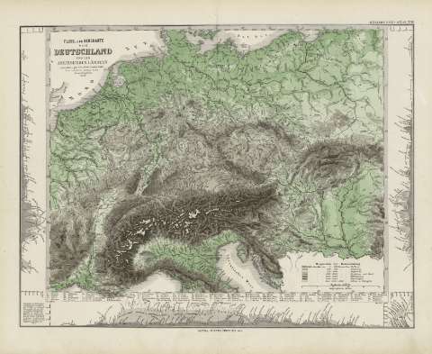
Fluss - und Bergkarte von Deutschland und den Anliegenden...


Section: Maps
Title: Fluss - und Bergkarte von Deutschland und den Anliegenden Ländern : [karte] / entworfen v. gez. von Adolf Stieler 1820
Author: Stieler, Adolf, 1775-1836
Edición: Neve vermehrte Aufl. 1857/Herm. Berghaus
Área de datos: Escala 1:4625000
Publication: Gotha [Alemania] : Justus Perthes, 1879
Physical description: 1 mapa : col. ; 32x41 cm, en h. de 39x48 cm, pleg. en 39x24 cm
Notes: Constan coordenadas sin especificar meridiano
Relieve por sombreado
Leyenda de signos utilizados
Inserta 3 mapas de altitudes
Registros relacionados: En: Hand atlas : über alle Theile der Erde und über das Weltgebäude. - Gotha [Alemania R.D.] : Justus Perthes, [1879]
Títulos secundarios: Europa. Central. Mapas físicos. 1879. 1:4625000 (1857)
UDC: (4-191.2)
Type of publication:
 Maps
Maps
Derechos: