
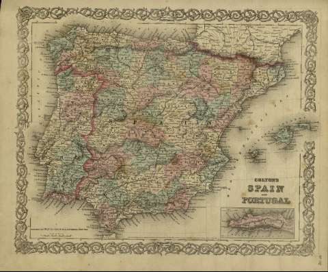
Colton's Spain and Portugal


Sección: Mapas
Título: Colton's Spain and Portugal / [drawn by George Woolworth Colton]
Área de datos: Escala [ca. 1:3.798.667], 80 miles [= 3'9 cm] (O 10º--E 4º /N 43º00'--N 35º40')
Publicación: New York : published by G.W. and C.B. Colton & Co., [1872]
Descripción física: 1 mapa : col. ; 36 x 44 cm
Notas: Indica meridianos de origen: Washington y Greenwich ; Márgenes graduados.
Indica divisiones administrativas marcadas por colores.
Inserta: Gibraltar.
Inserta nota: "Entered according to Act of Congress in the year 1855 by J.H. Colton & Co. in the Clerk's office of the district court for the southern district of New York".
Registros relacionados: En: Colton's General Atlas : containing one hundred and eighty steel plate maps and plans, on one hundred and nineteen imperial folio sheets. - New York : published by G.W. and C.B. Colton & Co. n 172 William St., [1872]. - Nº 102
Materia / lugar / evento: Mapas políticos
Divisiones administrativas - Mapas
España - S. XIX - Mapas
Portugal - S. XIX - Mapas
Otros autores: G.W. & C.B. Colton & Co.
Títulos secundarios: España. Mapas políticos. 1:3798667 (1872)
CDU: 912:[925.1+625.7](460-2/-5+469-2/-5)'1872'
460-2/-5
469-2/-5
Tipo de publicación:
 Mapas
Mapas
Derechos: