
Colton's China


Sección: Mapas
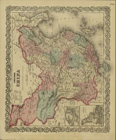
Título: Colton's China / [drawn by George Woolworth Colton]
Área de datos: Escala [ca. 1:12.345.666], 300 miles [= 4'5 cm] (E 90º--E 130º /N 45º--N 20º)
Publicación: New York : published by S.W. and C.B. Colton & Co., [1872]
Descripción física: 1 mapa : col. ; 36 x 44 cm
Notas: Indica meridianos de origen: Washington y Greenwich ; Márgenes graduados.
Indica divisiones administrativas marcadas por colores.
Inserta nota: "Entered according to Act of Congress in the year 1855 by J.H. Colton & Co. in the Clerk's office of the district court for the southern district of New York".
Inserta: Harbor & Island of Amoy ; Map of Canton and adjacent islands.
Registros relacionados: En: Colton's General Atlas : containing one hundred and eighty steel plate maps and plans, on one hundred and nineteen imperial folio sheets. - New York : published by G.W. and C.B. Colton & Co. n 172 William St., [1872]. - Nº 122
Materia / lugar / evento: Mapas políticos
Divisiones administrativas - Mapas
China - Mapas
Otros autores: G.W. & C.B. Colton & Co.
Títulos secundarios: CHINA. 1:12345666
CDU: 912:911.2(510-2/-5)'1872'
510
Tipo de publicación:
 Mapas
Mapas
Derechos: